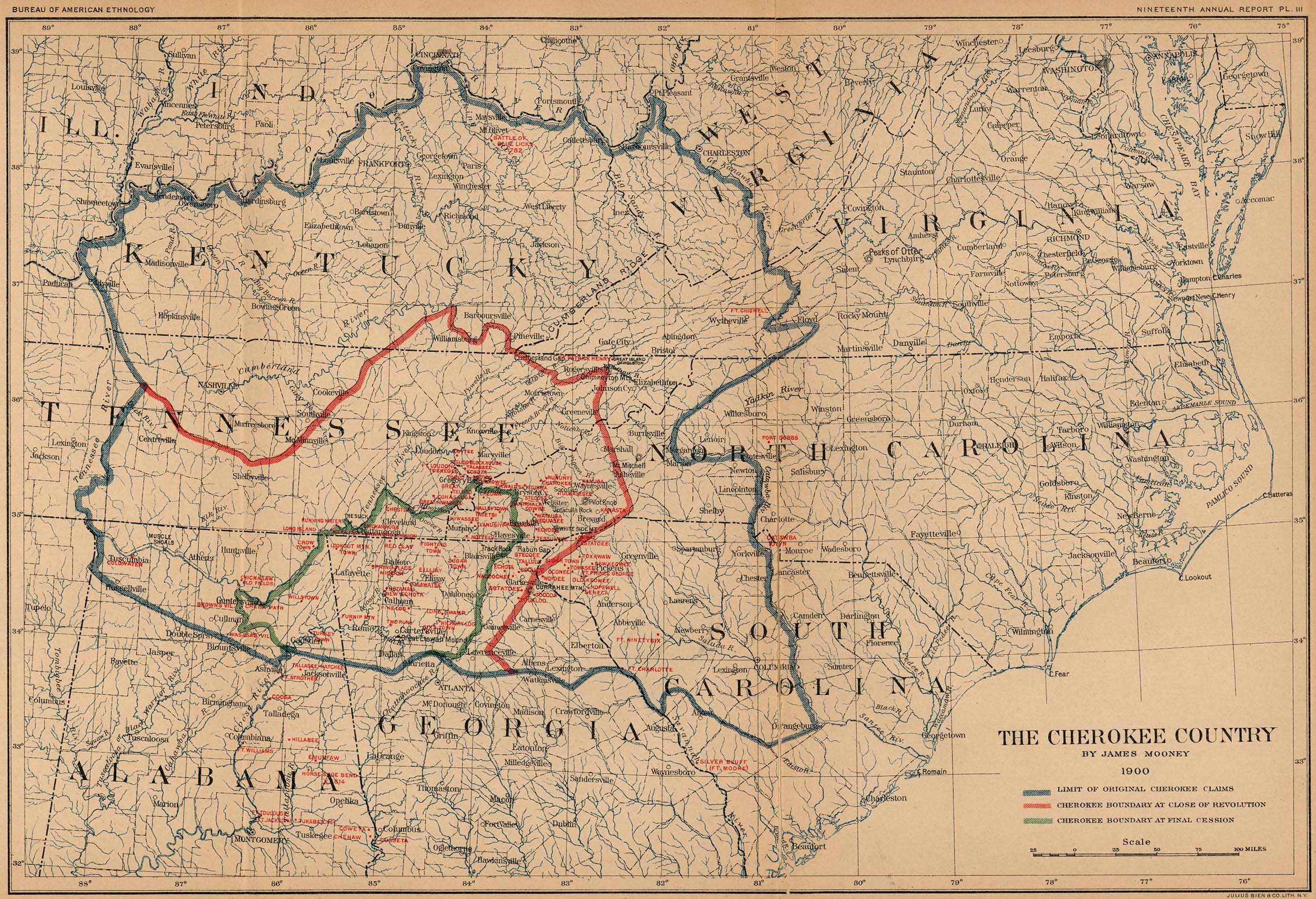
Boundaries of the Constitutional Cherokee NATION:
The outer edge of the map as shown here [noted in blue]:
Including some land on the outer edges that this map was not clear on... our people were settled on both sides of the rivers that this map used as outer boundaries.
We claim up to 40 acres outward beyond this map on all sides.
Names of State Chapters and their boundaries
The following state chapters are located within the outer boundaries of the map above of the historic homeland:
Alabma = Tsa-s-ga-ya-yi (yellow jacket place)
Georgia = Da-lo-ne-ga-yi (gold place)
Illinois = Ga-no-le-s-gi-yi (windy place)
Indiana = Do-tsu-wa-yi (cardinal place)
Kentucky = Sa-go-ni-ge Ka-ne-s-ga-yi (blue grass place)
North Carolina = U-ta-li-yi (mountain place)
Ohio = E-quo-ni-yi (river place)
Virginia = Tsu-na-da-da-tlu-tu-gi-yi (sweetheart place)
South Carolina = Ka-nv-si-ta-yi (dog wood place-- our range was everywhere a dogwod can naturally grow within SC)
Tennessee = Ta-na-si-yi (meets back)
In addition, we have established a chapter that is to locate, educate, and facilitate the return of their members to the homeland:
Western District (includes Arkansas, California, Missouri, Mississippi, Oklahoma, Texas and Mexico) = Wu-de-li-gv-di-tlv-yi (western place)
Names of Active Community Chapters and their boundaries or requirements
Jurisdiction of Auxiliaries
